Balranald Station |
| Main facility: | Station (Closed) |
| Lines: |
Balranald Line |
| Location: | line-map (143.5632°, -34.6606°) GDA94 |
| Distance: | 455.981 km from Melbourne |
| Photos: | 1927, 2000, 2002, 2005 |
| Description: | |
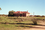
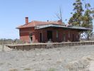
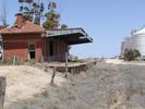
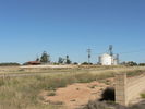
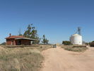
| Current status: | The line formation is visible next to the Sturt Highway for about 5 km east of the station, to the point where the road and rail crossed a creek. Reconstruction of the highway at the creek crossing has obliterated the location of the rail bridge. There is a silo which appears to be still in use adjacent to the station on the southern side of the line. |
Photographs

