Bringagee Station |
| Main facility: | Station (Closed) | ||||
| Lines: |
Hay Branch |
||||
| Location: | line-map (145.7004°, -34.4425°) GDA94 | ||||
| Distance: | 674.610 km from Sydney | ||||
| History: |
|
||||
| Other facilities: | Turntable: 51'6" manual, ruins (Probably ex-Victorian.) | ||||
| Photos: | 2000, 2007 | ||||
| Description: | |||||
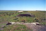
| Current status: | Foundations denote the one-time presence of a water tank, turntable and gangers shed. A lifted siding leads to a goods bank and cattle loader. A 2-lever frame lies at the eastern end. |
Photographs


