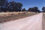
Pulletop Station |
| Main facility: | Platform (Closed) | ||||||
| Lines: |
Westby Branch |
||||||
| Location: | line-map (147.3857°, -35.4388°) GDA94 | ||||||
| Distance: | 585.100 km from Sydney | ||||||
| History: |
|
||||||
| Photos: | 1934, 1994, 2000 | ||||||
| Description: | Opened with just a down side loading bank and siding. Later a 30m platform was added on the up side. | ||||||
| Current status: | The concrete-faced loading bank still remains. The right of way is now used as an access track to a nearby property. |
Photographs


Diagrams
1925:


